Project Type - Locate Objects
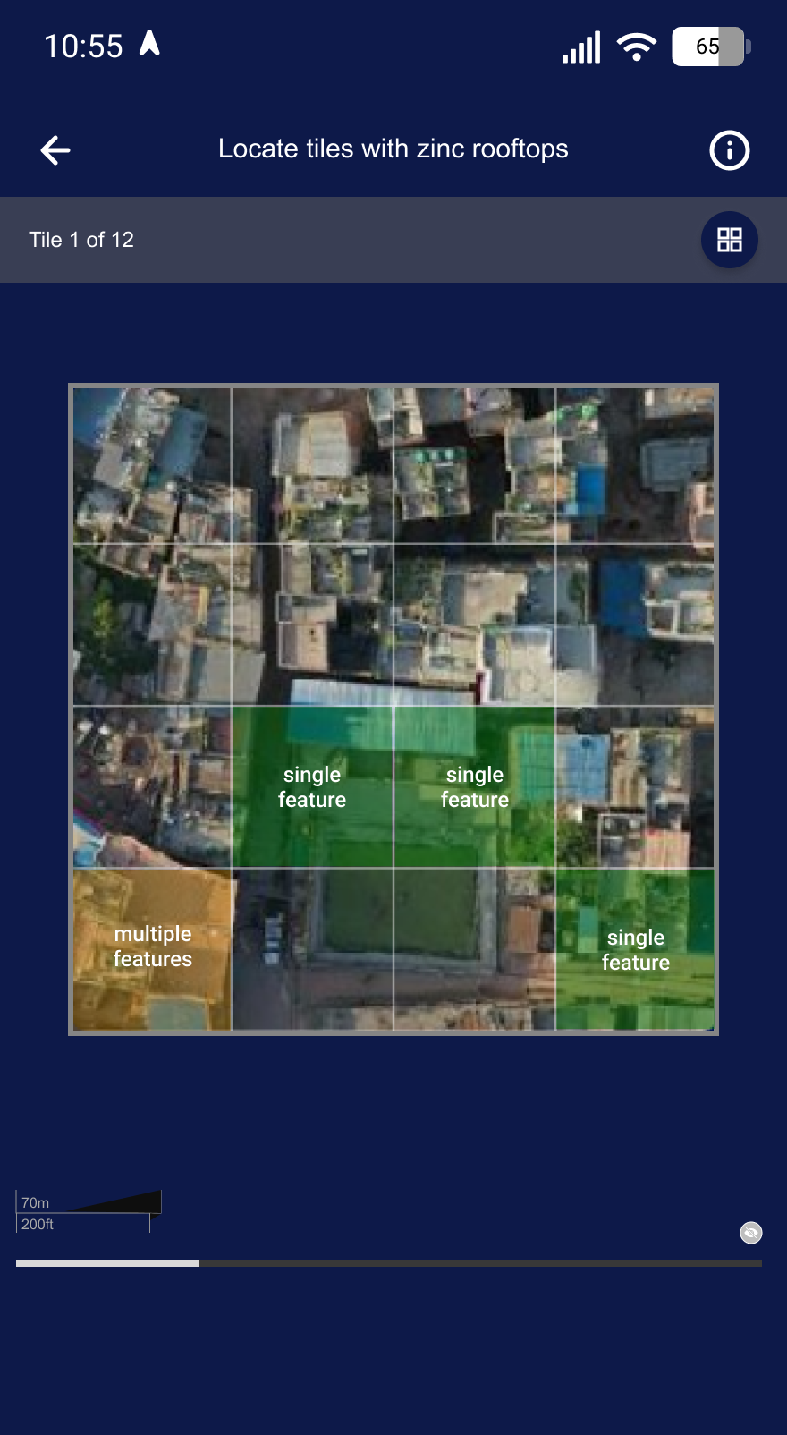
Unlike Find Features, which asks whether an object is present anywhere in a full imagery tile, Locate Objects asks where within the tile it is. A single imagery tile is shown per screen, virtually subdivided into a grid of smaller mini tiles (2x2, 4x4, or 8x8, chosen by the project manager). Contributors tap the mini tile(s) that contain an object:
- One tap (highlighted green) — a single object is present in that mini tile.
- Two taps (highlighted yellow) — multiple objects are present in that mini tile.
- No tap — no object in that mini tile.
The mini-tile grid is a virtual subdivision of the same tile/zoom level (quad-tree style), not a request for higher-zoom imagery. The output is intended to produce AI-ready training datasets (e.g. for HOT’s fAIr), so results capture per-mini-tile classification rather than a single yes/no per tile.
Locate Objects projects have projectType = 9.
Project
In addition to the common project fields documented in the data model, Locate Objects projects carry the following project-type-specific fields:
| Parameter | Type | Description |
|---|---|---|
| zoomLevel | int | Web Mercator zoom level at which tiles are served. |
| tileServer | object | Raster tile server configuration — includes a server name, url, credits, and an optional apiKey. |
| subGridSize | enum (string) | Size of the virtual mini-tile grid each screen’s tile is subdivided into: 2x2 (4 partitions), 4x4 (16 partitions), or 8x8 (64 partitions). |
| exportMetaKey | string | Key of an additional metadata entry attached to exports (e.g. "building"). |
| exportMetaValue | string | Value of that additional metadata entry (e.g. "roof_top"). |
| customOptions | list (optional) | Custom answer options for classifying a mini tile (each with a value, title, description, icon, iconColor, and optional sub-options) — overrides the default No / Single Feature / Multiple Features choices. |
Group
Locate Objects groups have no project-type-specific fields beyond the common group fields, plus the tile-map-service bounding-box coordinates shared with Find Features:
| Parameter | Type | Description |
|---|---|---|
| xMax | int | Maximum tile-X coordinate covered by the group. |
| xMin | int | Minimum tile-X coordinate covered by the group. |
| yMax | int | Maximum tile-Y coordinate covered by the group. |
| yMin | int | Minimum tile-Y coordinate covered by the group. |
Task
Each task is a single imagery tile, identical in shape to a Find Features task; the mini-tile grid shown to the contributor is derived client-side from subGridSize rather than stored per-task.
| Parameter | Type | Description |
|---|---|---|
| taskId | string | ID of the task, formatted as {zoomLevel}-{tileX}-{tileY}. |
| tileX | int | Tile-X coordinate of the task at zoomLevel. |
| tileY | int | Tile-Y coordinate of the task at zoomLevel. |
| geometry | string | Polygon geometry of the tile, generated from tileX, tileY and zoomLevel. |
| url | string | Tile URL for the imagery at tileX, tileY, zoomLevel. |
Result
Locate Objects deviates from the common result shape: instead of a single int per task, each entry in results (keyed by taskId) is a list of ints — one value per mini-tile partition, ordered by partition index. A subGridSize of 2x2 yields a 4-value list, 4x4 a 16-value list, 8x8 a 64-value list.
results: {
  "9-267-352": [1, 0, 0, 2, ...]
}
Each value uses the same integer encoding as customOptions (or the fallback below when none are supplied). When exported, the backend explodes each list into one row per partition, adding a task_partition_index column set to the value’s position in the list.
When the project creator does not supply customOptions, the backend falls back to the following defaults:
| Value | Title | Description |
|---|---|---|
0 | No | The mini tile does not contain a feature. |
1 | Single Feature | The mini tile contains a single feature. |
2 | Multiple Features | The mini tile contains multiple features. |